Multi-Objective Assessment of Flood Adaptation Options in Los Angeles County
About the Project
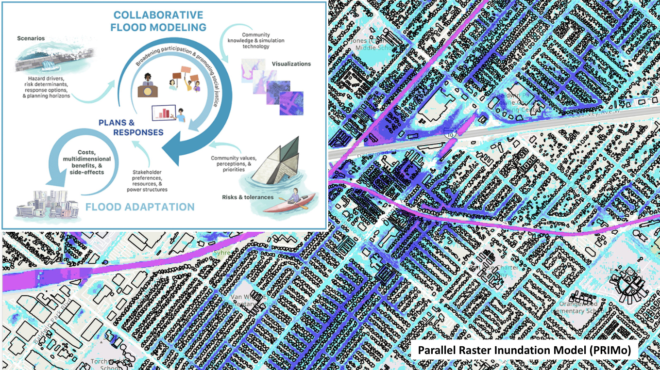
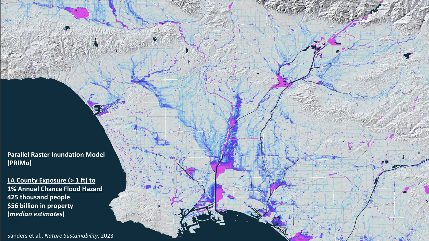
Los Angeles County, home to 10 million people and a $712 billion annual economy, faces flood risks 20 times greater than suggested by federally defined floodplains, and Black, Hispanic, and disadvantaged populations are disproportionately exposed to these risks. There is a need for transformative flood infrastructure that simultaneously reduces flood risk, captures more stormwater, restores impaired ecosystems, builds climate resilience across the region, and advances equity.
This project will simulate three flood adaptation approaches:
Raising levees
Widening rivers with habitat restoration
Capturing additional stormwater with more green infrastructure and parks
Researchers will then analyze the costs and benefits of each to provide actionable information to regional government.
The project is led by Dr. Brett Sanders at the University of California, Irvine, in collaboration with Dr. Katharine Mach at the University of Miami, and is funded through the NOAA Effects of Sea Level Rise (ESLR) Program. Read more about the project via NOAA and media coverage from LAist.
Research Team
UC Irvine


University of Miami


Workshop Series
In 2024 and 2025, LARC will host a series of workshops to facilitate the co-creation of three county-wide flood risk adaptation strategies: (a) raising levees, (b) widening channels, and (c) capturing stormwater.
February 8, 2024
Workshop #1
Project Design & Timeline Stormwater Capture & Channel Widening Strategies
March 13, 2025
Flood Control Infrastructure Adaptation in Los Angeles County
Questions?
If you have any questions about this project or would like to receive updates about this project, please email larc@ioes.ucla.edu.